
Georex – Advanced Geospatial Intelligence Platform
Transforming Data into Spatial Intelligence and Real-World Action
Georex is an advanced webGIS platform designed to help governments, cities, utilities, and organizations manage infrastructure, assets, and operations through powerful geospatial intelligence.
Built as a scalable, modular and fully web-based system, Georex transforms complex spatial data into clear, actionable insights—enabling institutions to plan better, respond faster, and operate more efficiently.
With proven deployments across municipalities, road authorities, and utility companies, Georex provides a reliable digital foundation for modern infrastructure management and smart city development.
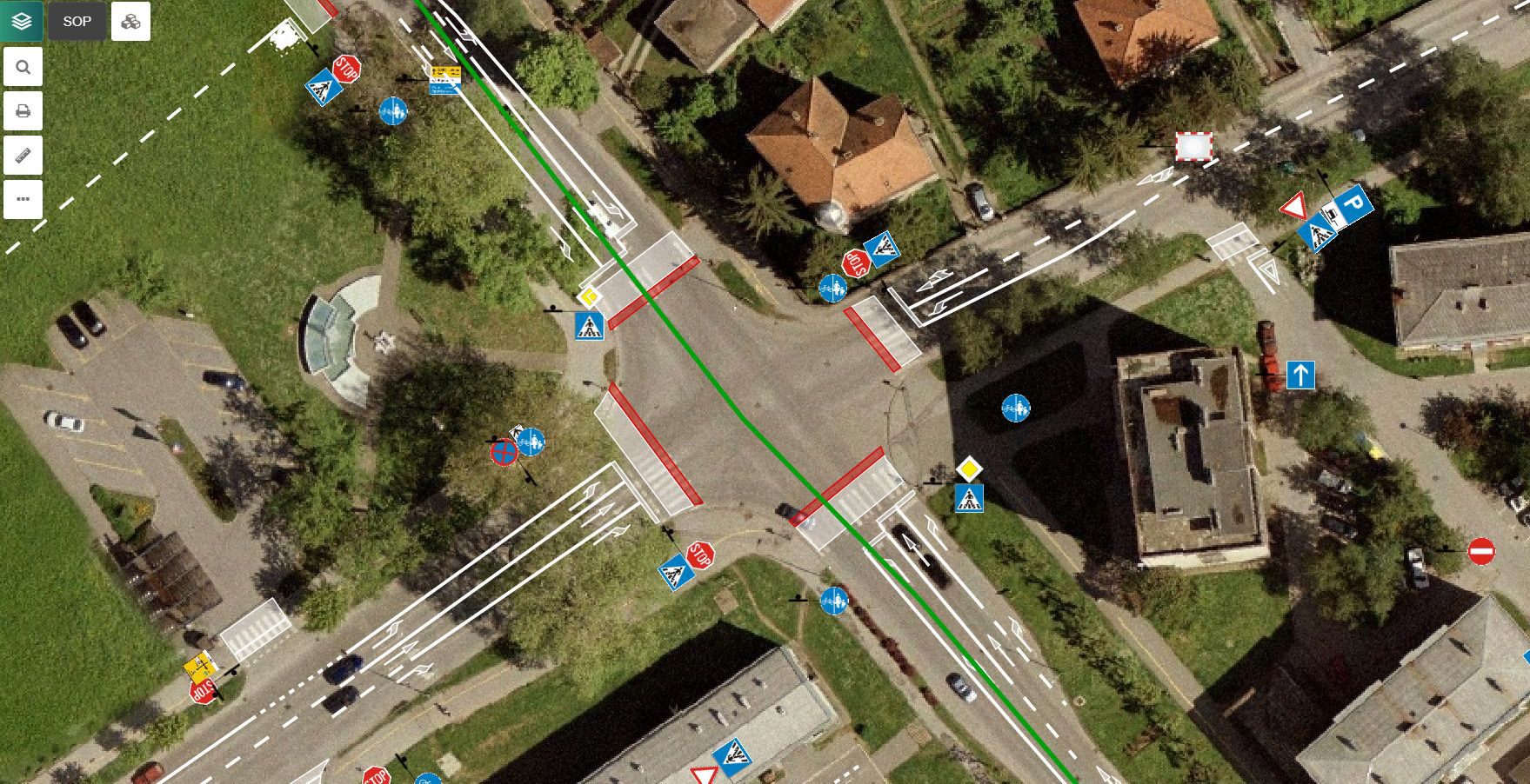
Why Georex Matters
From Disconnected Data to Spatial Intelligence
Many organizations still manage infrastructure, assets and field operations through disconnected systems, spreadsheets and static maps.
This results in:
- limited visibility over assets and infrastructure
- inefficient maintenance and intervention processes
- slow decision-making in critical situations
- lack of coordination between departments and field teams
- reduced transparency and public service quality
Georex replaces this fragmented approach with a centralized geospatial platform, where all data, assets, and operations are visualized and managed in real time.
Core Platform Architecture - A Unified webGIS Environment
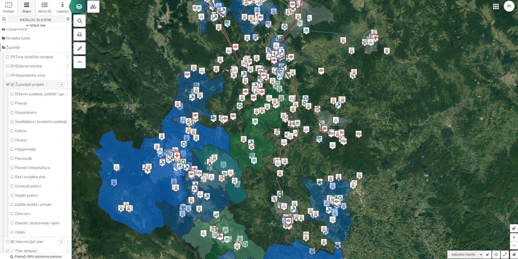
Georex is built as a dynamic, web-based GIS platform that integrates data, systems and users into one operational environment.
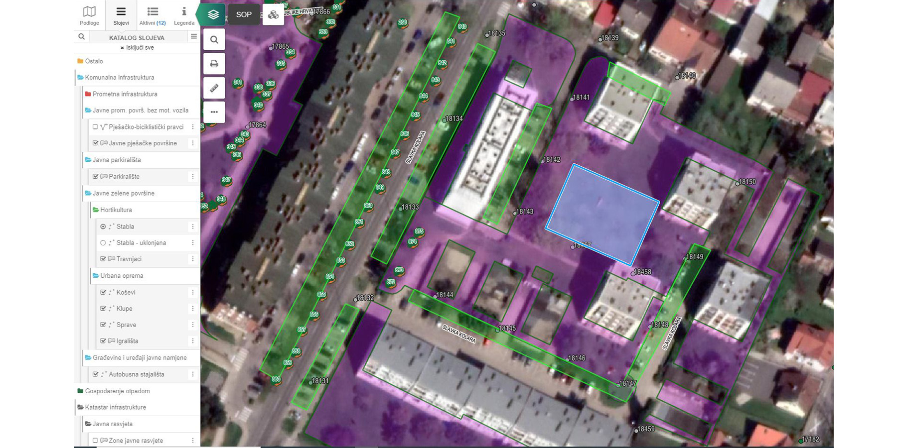
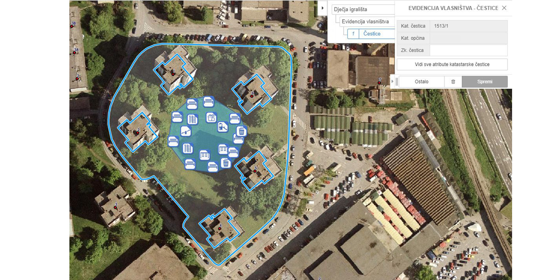
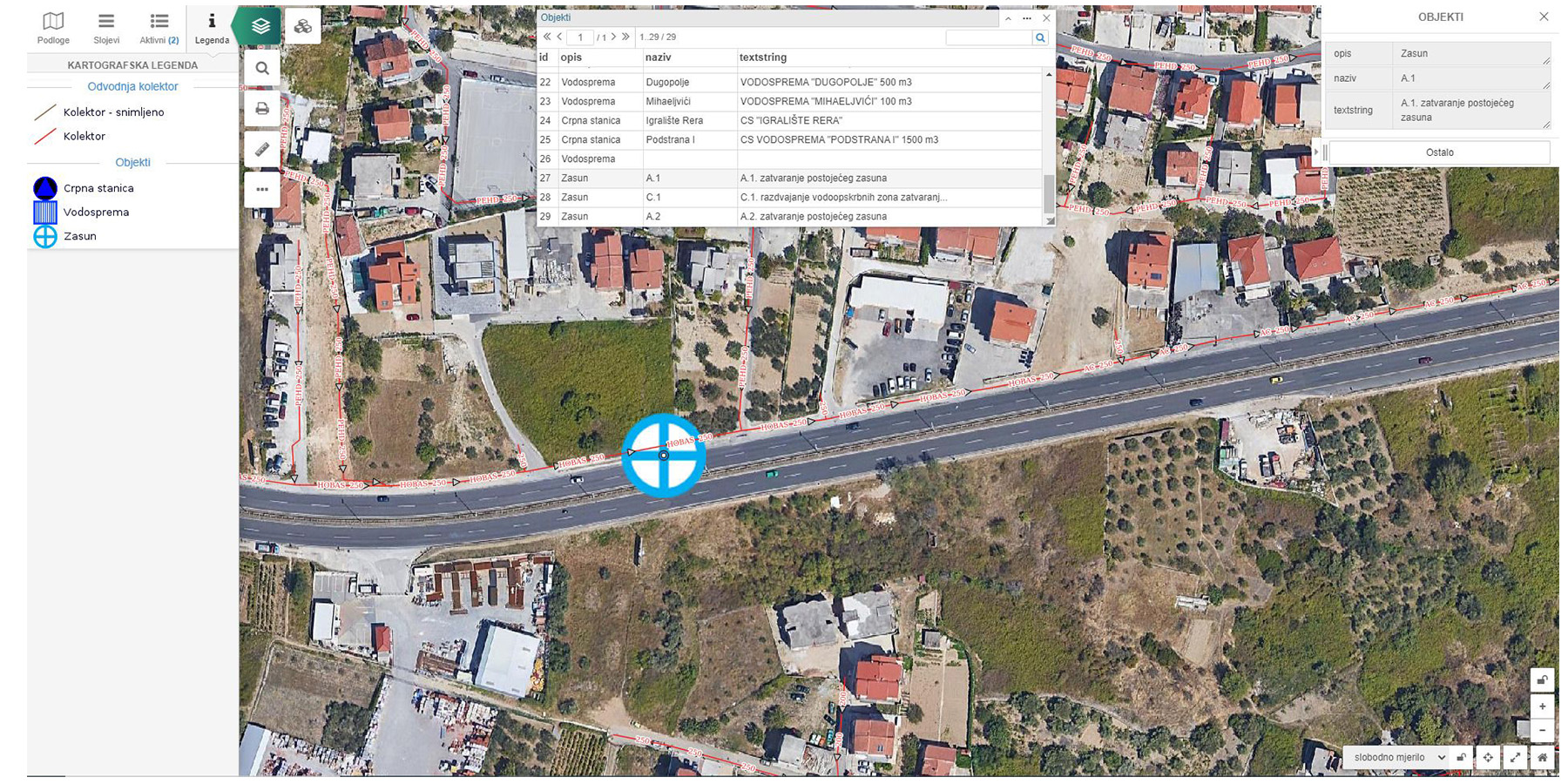
The platform enables:
- Visualization and management of spatial data in real time
- Centralized infrastructure and asset control
- Integration with external systems (GPS, sensors, cameras, ERP, CRM, IoT)
- Cross-device access (desktop, tablet, mobile)
- Custom map and report generation
- Unlimited user access with role-based control
Unlike traditional GIS systems, Georex is designed to be fully web-based, modular, and scalable, without dependency on costly third-party licenses.
Standard Challenges in Infrastructure & Asset Management
Organizations responsible for infrastructure and public services face recurring challenges:
- Fragmented asset data across departments
- Lack of real-time visibility into infrastructure condition
- Inefficient maintenance and intervention tracking
- Limited coordination between field teams and control centers
- Manual and slow reporting processes
- Poor integration with other systems and data sources
- Limited transparency toward citizens and stakeholders
These issues directly impact operational efficiency, costs, and service quality.
Conventional Solutions and Limitations
Traditional approaches typically rely on:
- static GIS systems with limited accessibility
- spreadsheets and manual asset records
- disconnected maintenance tracking tools
- isolated monitoring systems (GPS, sensors, cameras)
- paper-based or delayed reporting from field teams
This leads to:
- inconsistent and outdated data
- slow response times
- duplicated work
- lack of centralized control
- limited scalability
Georex Solution & Key Advantages
A Smarter Way to Manage Infrastructure and Operations
Georex introduces a fully integrated geospatial intelligence model.
Centralized Spatial Data Platform
All infrastructure, assets, and operational data are managed within one unified system.
Real-Time Operational Visibility
Decision-makers gain immediate insight into asset status, field activities, and ongoing operations.
Integrated Ecosystem
Seamless connection with IoT devices, GPS tracking, cameras and enterprise systems.
Scalable and Modular Architecture
Adaptable to cities, regions, or national-level deployments.
Cost Efficiency
Open-source architecture eliminates expensive licensing and reduces long-term operational costs.
Improved Coordination
Field teams and management operate within the same system, enabling faster and more accurate execution.
Core Modules
Georex provides a modular system that can be tailored to specific operational needs:
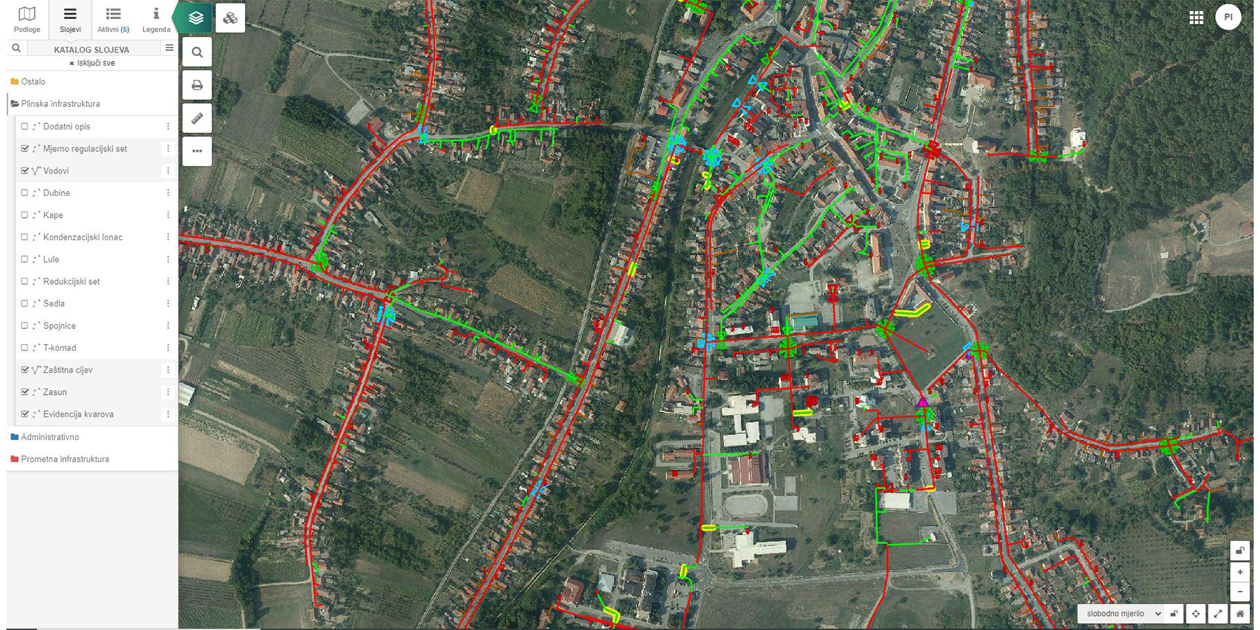
- Infrastructure Cadastre (roads, lighting, utilities, signage)
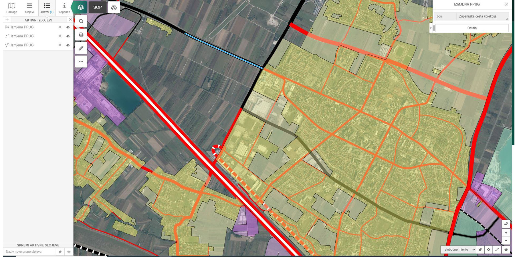
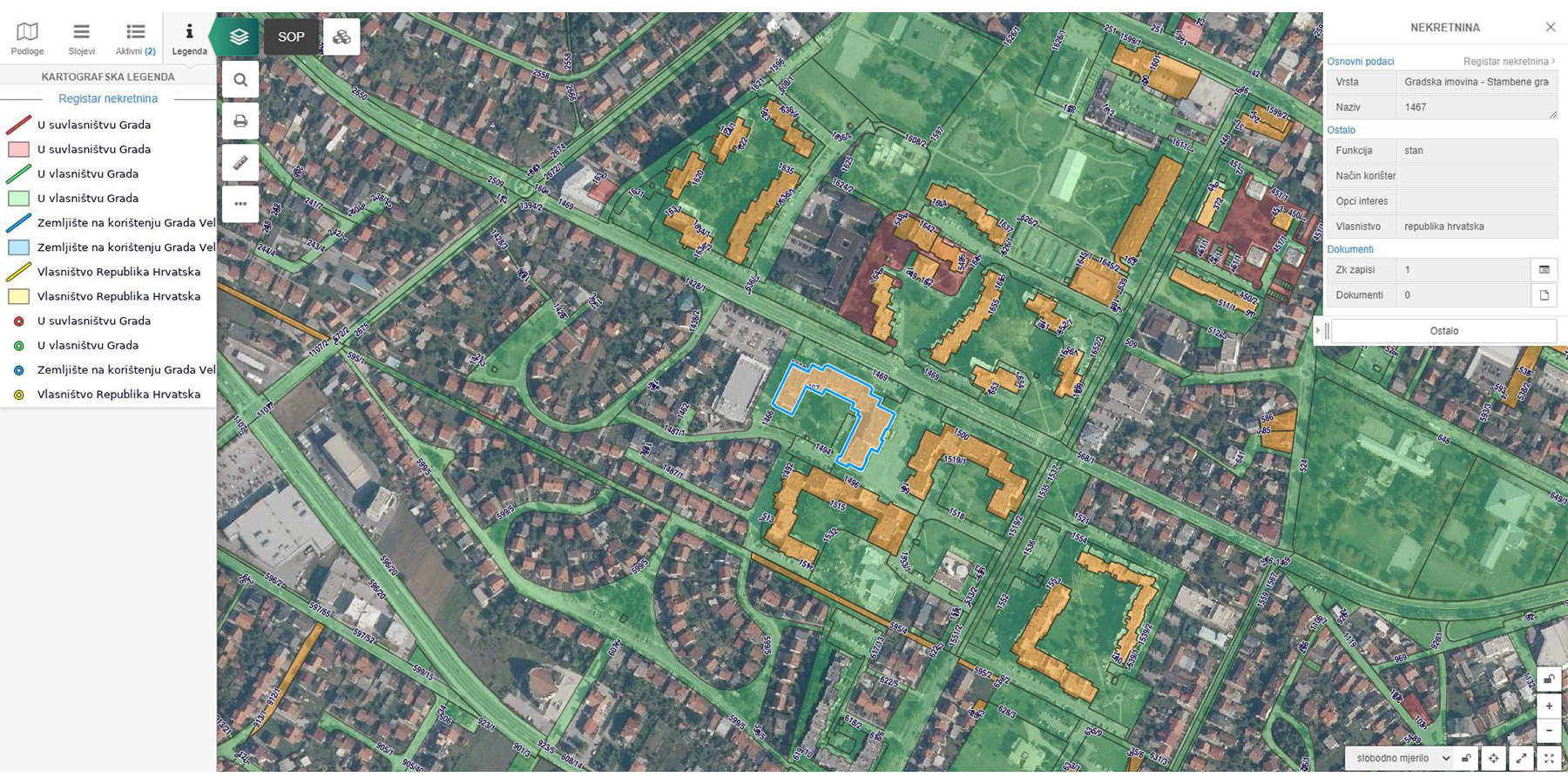
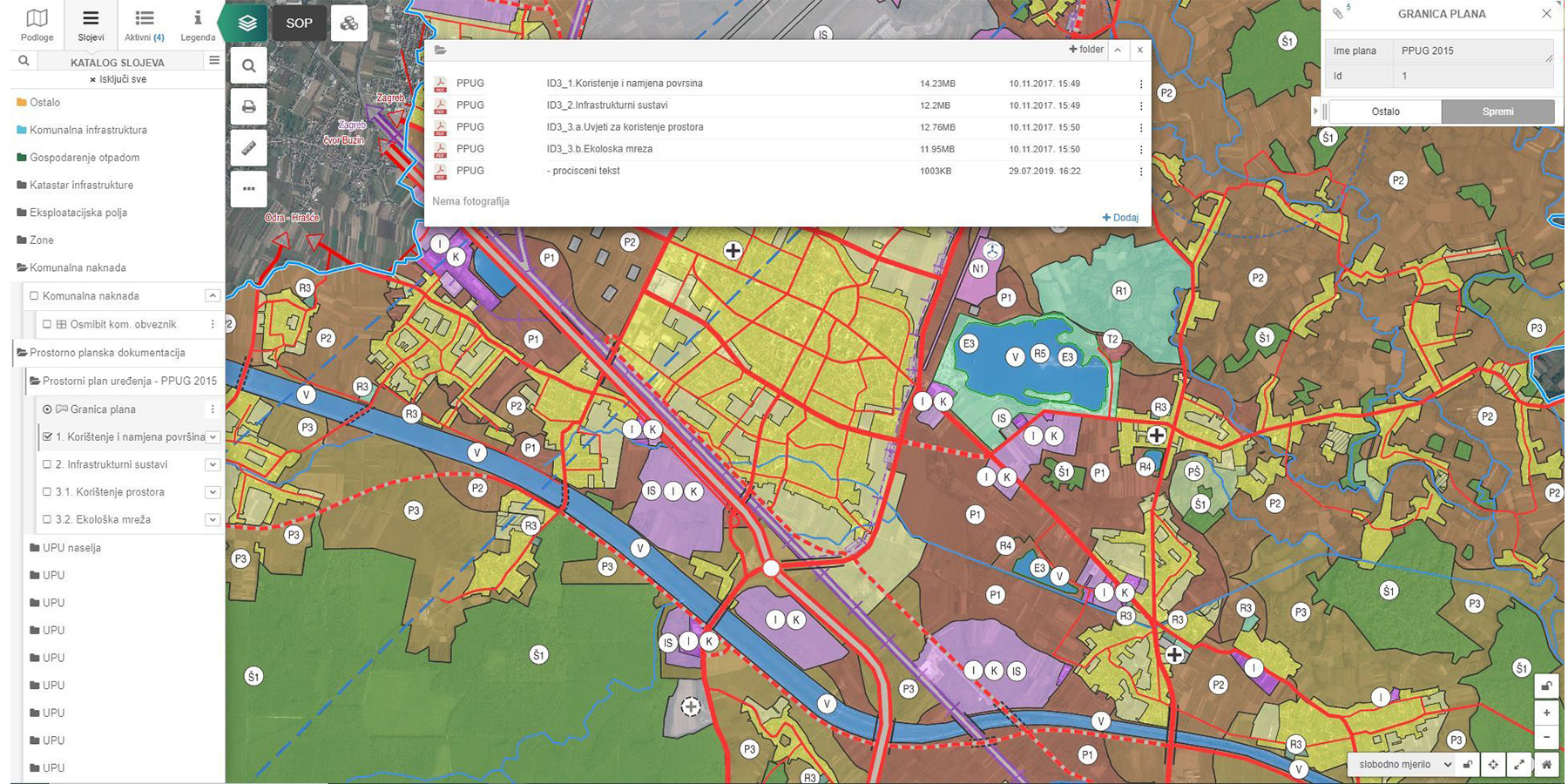
- Property Register & Spatial Planning
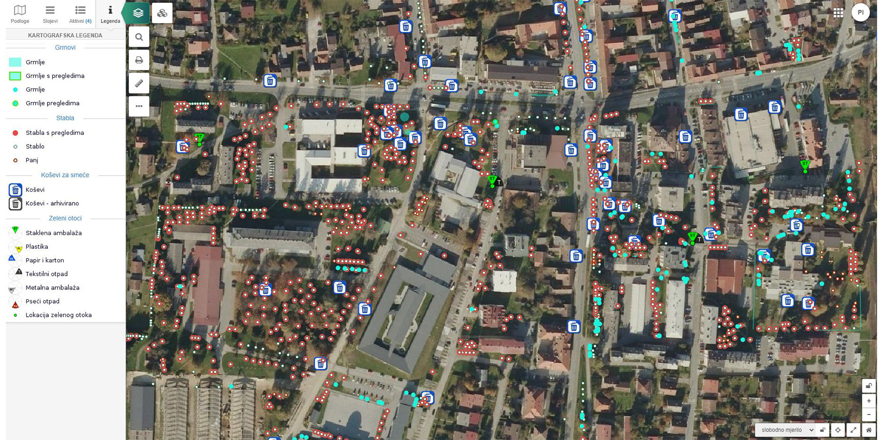
- Waste Management & Green Cadastre
- e-Interventions (maintenance and repair tracking)
- Crisis Management Application (web + mobile)
These modules create a comprehensive environment for managing both daily operations and strategic planning.
Sector Applications:
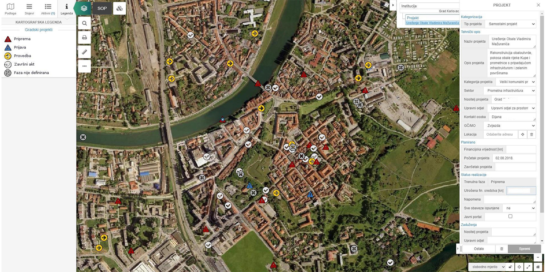
1. Government & Smart Cities
Building smarter, more efficient and transparent cities
Georex enables municipalities and public institutions to:
- manage infrastructure and assets centrally
- improve urban planning and zoning processes
- enhance transparency through public portals
- deliver better public services
- support long-term strategic development
2. Utilities & Infrastructure Operators
Full control over critical infrastructure systems
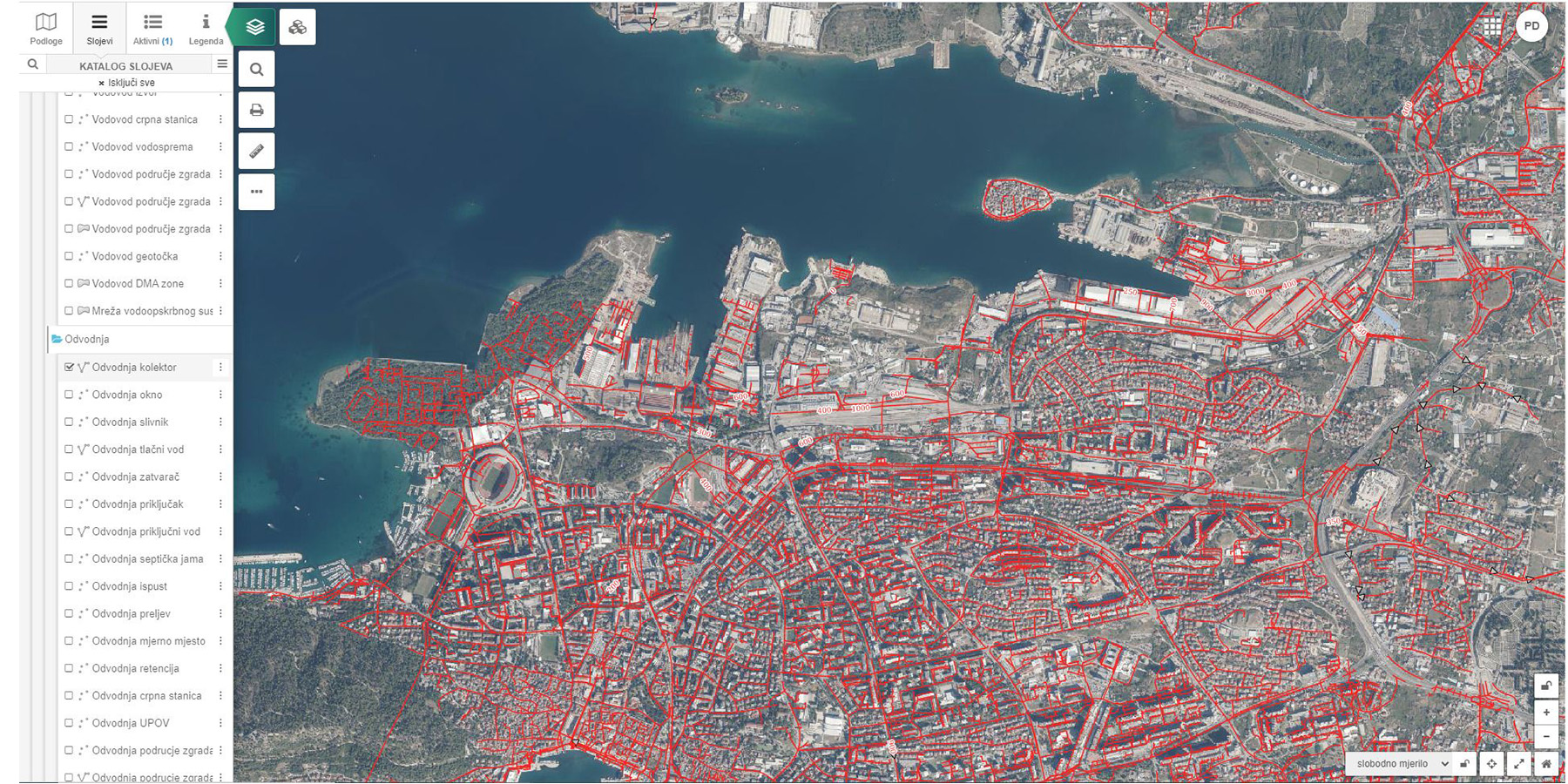
For utility companies and infrastructure providers, Georex supports:
- asset tracking and lifecycle management
- maintenance planning and intervention tracking
- network visualization and optimization
- integration with IoT and monitoring systems
3. Transport & Road Management
Smarter roads, safer infrastructure
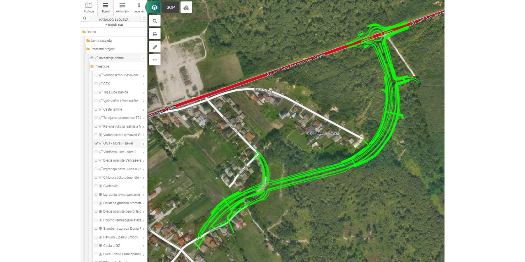
Georex is highly effective for:
- road asset management systems (RAMS)
- road safety programs (iRAP)
- lighting and traffic infrastructure management
- longitudinal profiling and 3D modeling
4. Environmental Monitoring
Managing natural resources with precision
The platform enables monitoring and management of:
- air quality
- water systems
- waste management
- green areas and environmental assets
5. Emergency & Crisis Management
Faster response through real-time intelligence
Georex provides a powerful operational tool for:
- emergency response coordination
- real-time incident tracking
- field team deployment and monitoring
- situational awareness and decision support
6. Citizen Engagement & Transparency
Connecting citizens with city services
Georex enhances public interaction through:
- public web portals
- mobile reporting applications
- real-time service tracking
- interactive spatial tools
This improves transparency, accountability, and citizen satisfaction.
Built for Africa’s Infrastructure Growth
Africa is experiencing rapid urbanization and infrastructure expansion, creating a strong need for modern, scalable and efficient management systems.
Georex is designed to support this growth by:
- adapting to diverse infrastructure environments
- enabling large-scale deployments across cities and regions
- supporting digital transformation initiatives
- improving operational efficiency and cost control
With its modular design and compliance with international GIS standards, Georex is ready to support national, regional and city-level projects across Africa.
Where Georex Creates the Most Value
Georex is particularly suited for:
- municipalities and smart city projects
- utility companies and infrastructure operators
- road authorities and transport agencies
- environmental agencies
- emergency and crisis response systems
- development agencies and public projects
A Platform for the Future of Spatial Intelligence
Georex transforms geospatial data into a strategic operational asset.
By combining data, mapping, real-time intelligence and system integration, it enables organizations to move from reactive management to proactive, data-driven decision-making.
Georex is not just a GIS system. t is a platform for modern infrastructure intelligence.
Traditional GIS vs. Georex
| Category | Traditional Systems | Georex Platform |
|---|---|---|
| Data Management | Fragmented systems | Centralized geospatial platform |
| Accessibility | Desktop-only | Web, mobile, tablet |
| Real-Time | Static maps | Live visualization |
| Integration | Limited | IoT, GPS, ERP integration |
| Users | Limited licenses | Unlimited access |
| Field Work | Manual reports | Real-time mobile reporting |
| Maintenance | Reactive | Proactive tracking |
| Scalability | Costly | Modular & scalable |
| Costs | High licensing | Open-source model |
| Decision Making | Slow | Data-driven |
| Transparency | Limited | Public portals |
| Crisis Management | Disconnected | Integrated real-time system |
From Fragmented Systems to Spatial Intelligence
BEFORE – Traditional
Disconnected. Reactive. Inefficient.
- Multiple spreadsheets
- Static maps
- Limited visibility
- Manual reporting
- Slow response
- Poor coordination
- High costs
- Low transparency
AFTER – Georex
Connected. Real-Time. Intelligent.
- Centralized data
- Real-time maps
- Full visibility
- Mobile reporting
- Fast response
- Seamless coordination
- Optimized costs
- High transparency
Result: Smarter Infrastructure. Faster Decisions. Better Services.
Georex transforms how organizations manage space, assets and operations—turning complex data into clear insights and real-world action.
Get Started
If you are interested in implementing Georex or exploring partnership opportunities, click HERE to learn more.